SNOWFLAKE PATHWAYS
A HISTORY IN PICTURES
![]()
Maps of Pathway Network
This map is overlaid on a satellite photo. To our surprise, you can see quite a lot of the trail system from "space", so consequently the map is to scale and quite accurate.
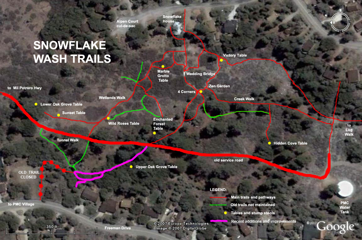
The fuchsia colored pathway is a more recent addition (work started in March, 2008). It replaces an original path, now closed because it crosses a building site (shown on the map with red dots to indicate it is no longer passable). This new pathway allows easy access all the way from Alpen Court, up to Freeman Drive, and onto the PMC village (and vise versa). This is a popular route used by many people to get to the village center (to the post office, shops, restaurants, etc.)
![]()
Another photo showing what this area looks like from space. This is a more recent satellite photo taken in March, 2008. Freeman Drive is on the left, and Alpen Court (with cul-de-sac) on the right. The top of this map points north.
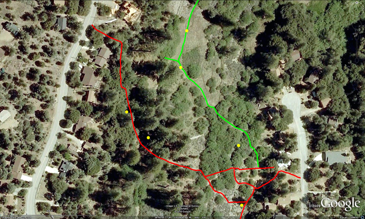
Two of the main pathways are shown above. The Wetlands route is shown in green. The Main pathway, that crosses the green belt, is shown in red. The yellow dots indicate the location of tables and stump stools.
If you would like a copy of these maps, please send me your e-mail address to snowflaketrails@gmail.com and I will e-mail you copies.
![]()